
ስዕል:Hanoi location map.svg

Size of this PNG preview of this SVG file: 512 × 512 pixels. Other resolutions: 240 × 240 pixels | 480 × 480 pixels | 768 × 768 pixels | 1,024 × 1,024 pixels | 2,048 × 2,048 pixels.
ዋና ፋይል (የSVG ፋይል፡ በተግባር 512 × 512 ፒክስል፤ መጠን፦ 226 KB)
ማጠቃለያ
| ማጠቃለያ |
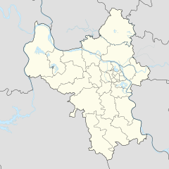
English: Location map of Hanoi |
| ቀን | |
| ምንጭ | Own work |
| አቅራቢው | Mai Ngọc Xuân |
| SVG genesis | This locator map was created with Adobe Illustrator. |
የፈቃድ አይነት፦
I, the copyright holder of this work, hereby publish it under the following license:
This file is licensed under the Creative Commons Attribution-Share Alike 4.0 International license.
- You are free:
- to share – to copy, distribute and transmit the work
- to remix – to adapt the work
- Under the following conditions:
- attribution – You must give appropriate credit, provide a link to the license, and indicate if changes were made. You may do so in any reasonable manner, but not in any way that suggests the licensor endorses you or your use.
- share alike – If you remix, transform, or build upon the material, you must distribute your contributions under the same or compatible license as the original.
የፋይሉ ታሪክ
የቀድሞው ዕትም ካለ ቀን/ሰዓቱን በመጫን መመልከት ይቻላል።
| ቀን /ሰዓት | ናሙና | ክልሉ (በpixel) | አቅራቢው | ማጠቃለያ | |
|---|---|---|---|---|---|
| ያሁኑኑ | 20:35, 1 ዴሰምበር 2022 | | 512 × 512 (226 KB) | Hakutora | add water layer |
| 04:38, 14 ኦገስት 2021 |  | 512 × 512 (43 KB) | Hari caaru | Adjust boundaries | |
| 13:45, 14 ኦክቶበር 2017 |  | 512 × 512 (43 KB) | Hakutora | update | |
| 15:54, 5 ኦክቶበር 2017 |  | 512 × 511 (139 KB) | Hakutora | User created page with UploadWizard |
ይህን ፋይል የሚያጠቃልሉ ገጾች
ወዲህ ፋይል የተያያዘ ገጽ የለም።
ሌሎች ውኪዎች
የሚከተሉት ሌሎች ውኪዎች ይህን ፋይል ይጠቀማሉ፦
- Usage on en.wikipedia.org
- Noi Bai International Airport
- Gia Lâm district
- Đông Anh district
- Thanh Trì district
- Ba Vì district
- Chương Mỹ district
- Đan Phượng district
- Hoài Đức district
- Mỹ Đức district
- Phú Xuyên district
- Phúc Thọ district
- Quốc Oai district
- Thạch Thất district
- Thanh Oai district
- Thường Tín district
- Ứng Hòa district
- Mê Linh district
- Lĩnh Nam
- Module:Location map/data/Vietnam Hanoi
- Module:Location map/data/Vietnam Hanoi/doc
- Linh Đàm
- Khương Đình
- Usage on fr.wikipedia.org
- Usage on ia.wikipedia.org
- Usage on id.wikipedia.org
- Usage on ja.wikipedia.org
- Usage on ms.wikipedia.org
- Usage on ru.wikipedia.org
- Usage on si.wikipedia.org
View more global usage of this file.