
ስዕል:Relief map of Solomon Islands.png

Size of this preview: 800 × 460 pixels. Other resolutions: 320 × 184 pixels | 640 × 368 pixels | 945 × 543 pixels.
ዋና ፋይል (945 × 543 ፒክስል፤ መጠን፦ 407 KB፤ የMIME ዓይነት፦ image/png)
ማጠቃለያ
| ማጠቃለያ |
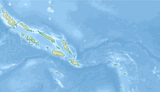
Русский: Физическая карта Соломоновых островов.
English: Relief map of Solomon Islands.
Equirectangular projection. Geographic limits of the map:
|
| ቀን | |
| ምንጭ |
|
| አቅራቢው | Nzeemin |
| ሌሎች ዕትሞች |
|

የፈቃድ አይነት፦
I, the copyright holder of this work, hereby publish it under the following license:
This file is licensed under the Creative Commons Attribution-Share Alike 3.0 Unported license.
- You are free:
- to share – to copy, distribute and transmit the work
- to remix – to adapt the work
- Under the following conditions:
- attribution – You must give appropriate credit, provide a link to the license, and indicate if changes were made. You may do so in any reasonable manner, but not in any way that suggests the licensor endorses you or your use.
- share alike – If you remix, transform, or build upon the material, you must distribute your contributions under the same or compatible license as the original.
የፋይሉ ታሪክ
የቀድሞው ዕትም ካለ ቀን/ሰዓቱን በመጫን መመልከት ይቻላል።
| ቀን /ሰዓት | ናሙና | ክልሉ (በpixel) | አቅራቢው | ማጠቃለያ | |
|---|---|---|---|---|---|
| ያሁኑኑ | 16:26, 20 ኖቭምበር 2012 | | 945 × 543 (407 KB) | Nzeemin | User created page with UploadWizard |
ይህን ፋይል የሚያጠቃልሉ ገጾች
ወዲህ ፋይል የተያያዘ ገጽ የለም።
ሌሎች ውኪዎች
የሚከተሉት ሌሎች ውኪዎች ይህን ፋይል ይጠቀማሉ፦
- Usage on ast.wikipedia.org
- Usage on az.wikipedia.org
- Usage on be.wikipedia.org
- Usage on bn.wikipedia.org
- Usage on cs.wikipedia.org
- Usage on da.wikipedia.org
- Usage on de.wikipedia.org
View more global usage of this file.